
Date: October 11, 2018
Location: Tibetan Plateau (Qihu Lake, Jialong Cuo Lake, Galong Cuo Lake)
Project Background
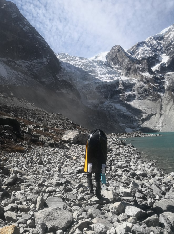
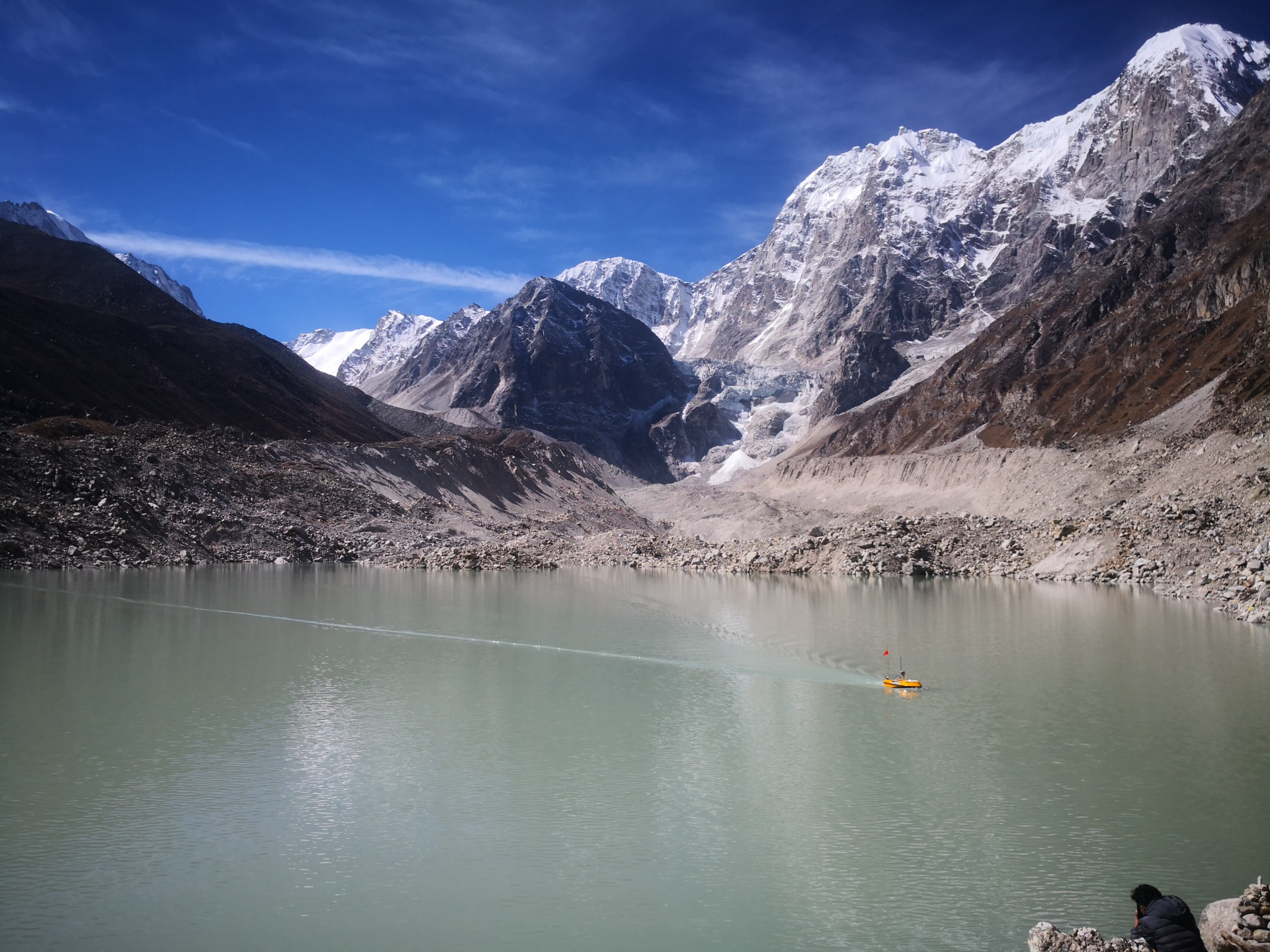
In October 2018, a six-person expedition team comprising surveyors from OceanAlpha, the Qinghai-Tibet Plateau Institute of the Chinese Academy of Sciences, and the University of Zurich (Switzerland) embarked on a challenging mission to Tibet. Their objective was to systematically survey three previously unmeasured plateau glacial lakes – Qihu Lake, Jialong Cuo Lake, and Galong Cuo Lake – to determine their depth profiles, calculate water storage capacity, and assess potential hazard levels.
Challenges of High-Altitude Surveying
The expedition faced extreme environmental conditions:
- Average altitude: 4,500 meters
- Daytime temperature: ~7°C
- Nighttime temperature: ~-10°C
- Logistical constraints: Limited transportation (manpower and horses only)
- Power limitations: Heavy generation equipment impractical; reliance on limited battery resources
OceanAlpha engineer Huang Cheng noted: “The high altitude, large temperature variations, and heavy workload presented significant physical challenges. The remote locations of these icy lakes required careful planning and resource management.”
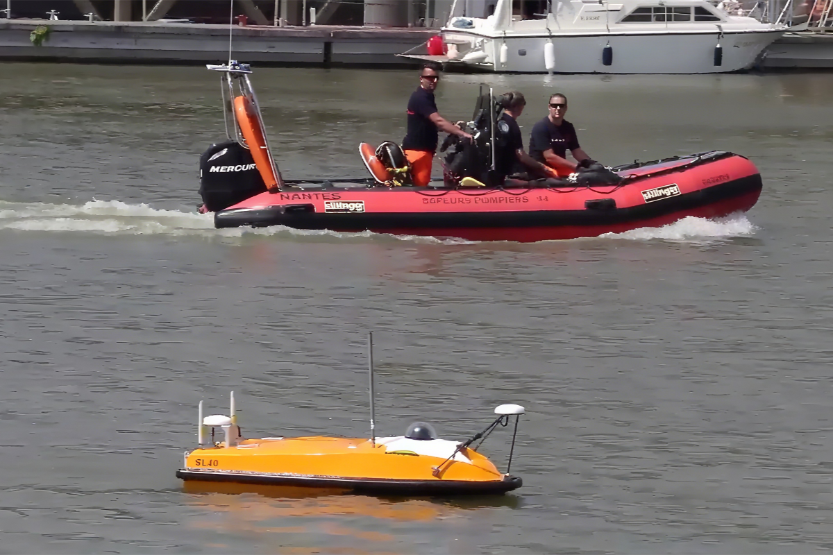
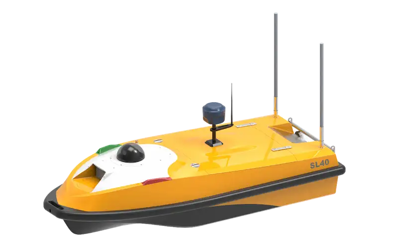
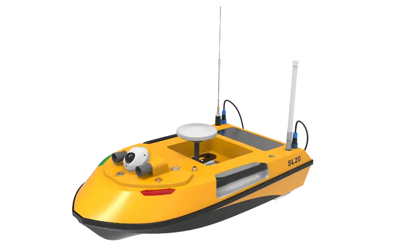
Survey Execution with SL20 USV
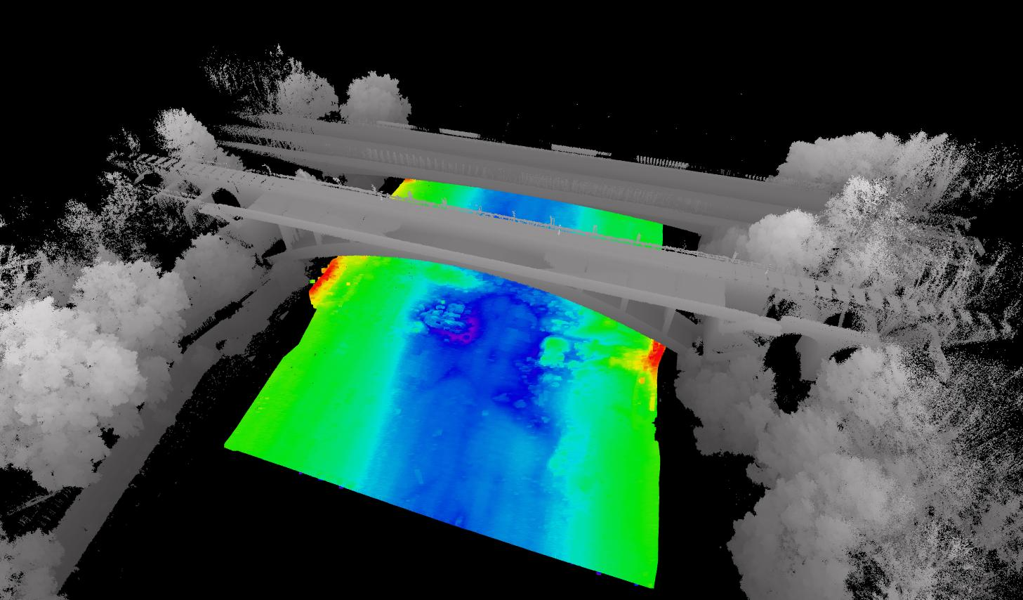
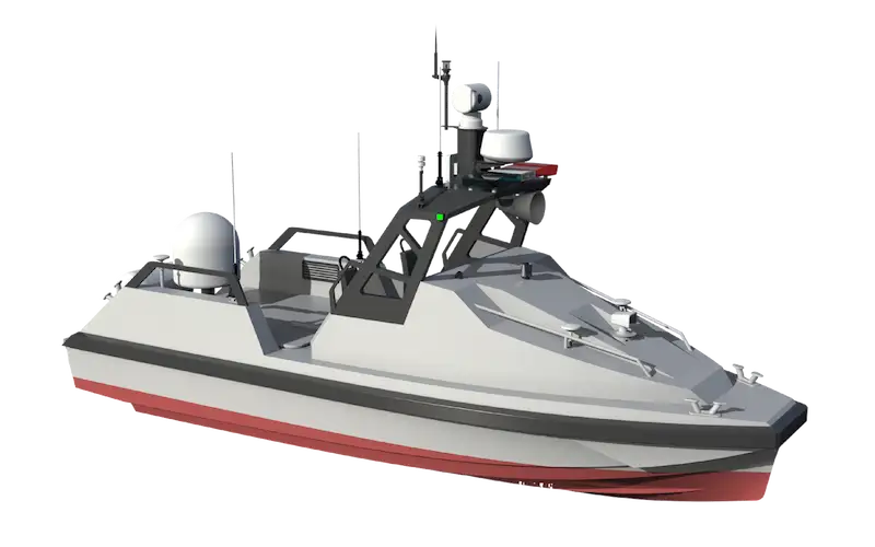
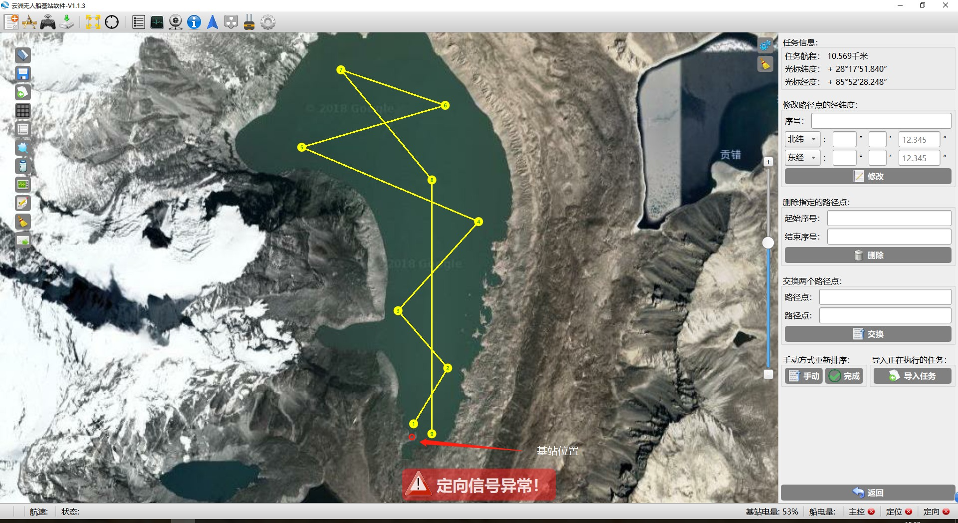
The team deployed the OceanAlpha SL20 Unmanned Surface Vessel (USV) to conduct autonomous bathymetric surveys:
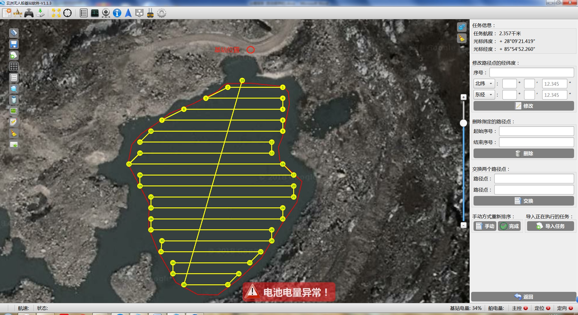
Qihu Lake (7,400m altitude)
-
- Base station antenna positioned at 6m height for optimal communication
- 0.02 km² autonomous survey completed
- Survey route carefully planned to maximize data quality
Jialong Cuo Lake (4,300m altitude)
-
- 0.5 km² autonomous survey executed over two days
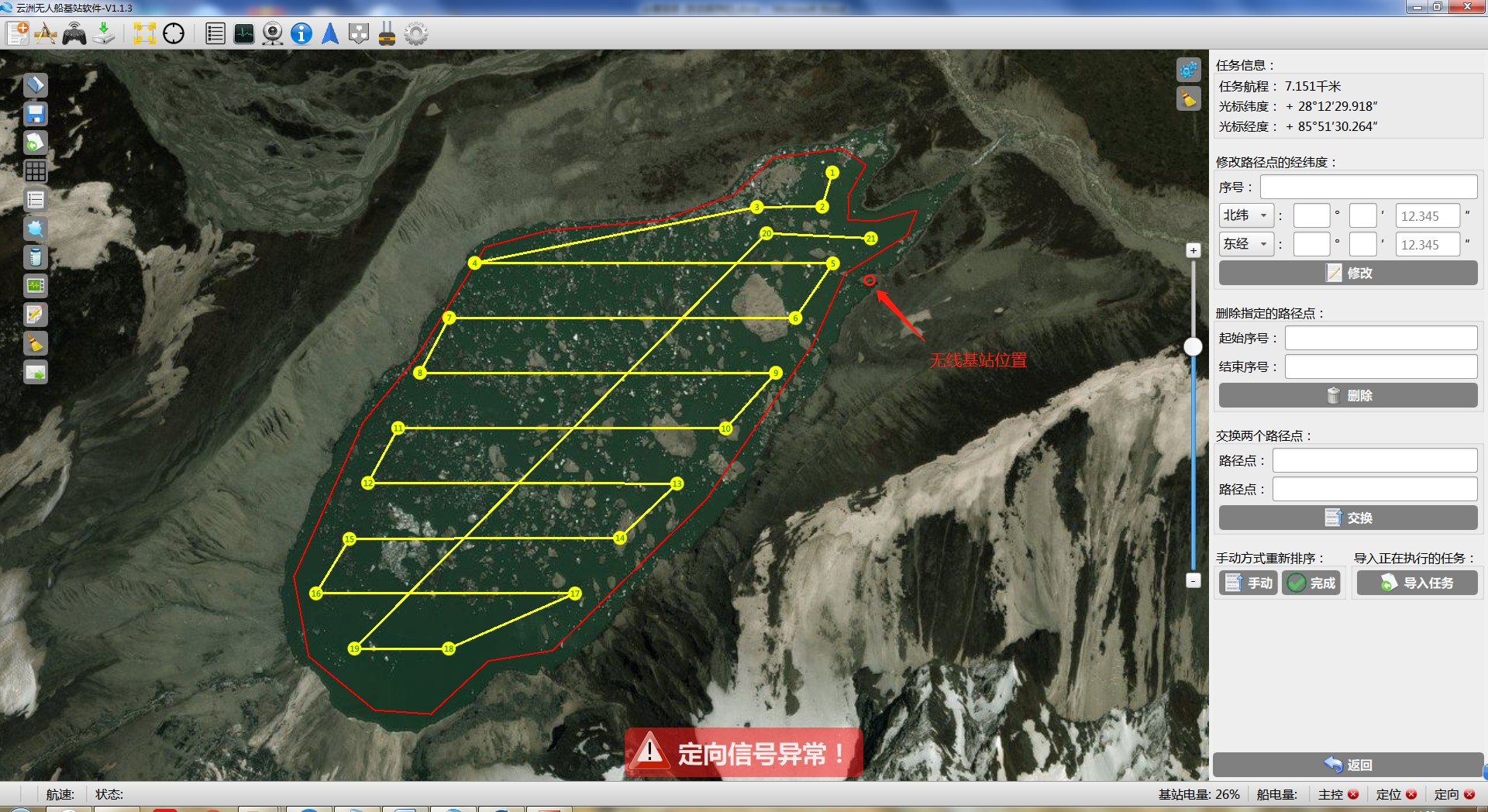
Galong Cuo Lake (5,070m altitude)
-
- 5 km² autonomous survey completed – the largest survey area of the expedition
Advantages of USV Technology in Harsh Environments
The SL20 USV demonstrated significant advantages over traditional survey methods:
- Transportability: Compact and lightweight design enabled transportation by horse or manpower to remote lake locations
- Operational Efficiency: Continuous autonomous operation reduced surveyors’ exposure to harsh conditions
- Safety Enhancement: Remote operation from the lakeshore base station minimized risks associated with:
- Working on unstable ice surfaces
- Potential falls into dangerously cold water
- Exposure to high-altitude environments
“The unmanned boat’s flexibility in transportation and continuous operation significantly improved our survey efficiency while reducing risks to personnel,”explained Huang Cheng. The SL20 USV allowed the team to gather critical hydrographic data in one of the world’s most challenging survey environments while maintaining safety and operational efficiency.