Time: November , 2022
Location: Scotland
Background:
Beavers create shelter by digging tunnels and constructing lodges from wood debris, twigs, and soil, known as burrows. However, these burrows contribute to more fragile riverbanks, leading to problems for individuals living and working alongside the river. To locate these burrows, OceanAlpha’s UK partner – Storm Geomatics Ltd is utilizing NORBIT’s sonar device to scan the riverbed. This collaboration is enabling humans and beavers to coexist in a safe and sustainable manner. If you’re interested in learning more about this innovative partnership, be sure to check out the article from the BBC.
Read the original artical “Sonar used to detect underwater beaver burrows” by Kevin Keane (BBC Scotland’s environment correspondent), available at BBC website: https://www.bbc.co.uk/news/uk-scotland-63811995
Sonar technology is being used for the first time in Scotland to detect the underwater entrances of beaver burrows.
Beavers’ homes can often create problems for landowners when the tunnels cause river banks to collapse.
Scottish government agency NatureScot challenged the private sector to use technology to work out where they live.
It is hoped the sonar technique will allow early measures to be put in place to prevent damage to land.
Beavers build the openings to their burrows underwater to prevent predators from entering.
Equipment
OceanAlpha SL40 Hydrographic Survey boat
NORBIT Sonar
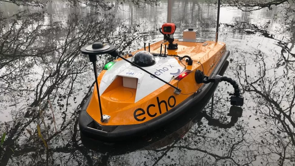
A survey vessel with side-scanning sonar devices attached is used to find the beaver entrances.
Process
They then dig upwards – often close to the surface – to create a network of dry tunnels which are clear of the water line.
Until a beaver burrow collapses, people above ground cannot work out where it is.
So the underwater burrow entrances are being identified using survey vessels which have multibeam sonar devices attached.
They record millions of data points as they navigate along the water.
A three-dimensional image can then be created which helps identify the opening to the burrow.
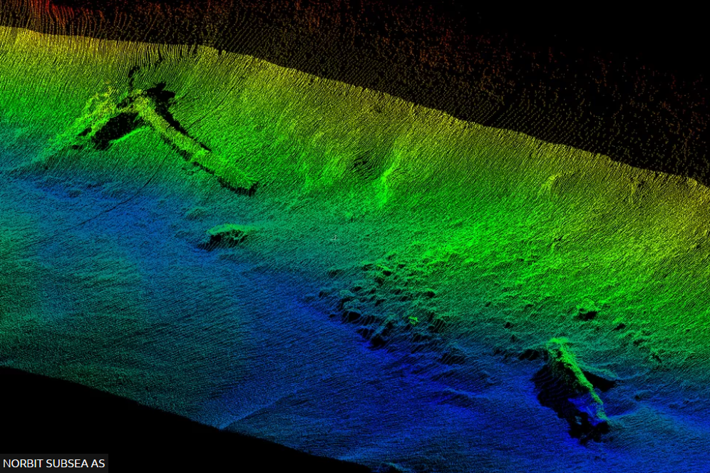
The sonar creates a three-dimensional image to help identify the opening to the burrow
Conclusion
Roo Campbell, from NatureScot, told BBC Scotland: “Burrowing is one of these behaviours where it’s quite difficult for us to understand what’s going on because burrows are very difficult to detect.
“We don’t always know where they are until something goes wrong and then we don’t often have a good understanding of the risk.
“We need to learn how to live alongside these animals and a project like this is part of that learning.”
The technology is being used as part of the Scottish government’s CivTech project, where the private sector is challenged to come up with solutions to problems.
It is being piloted in Tayside, where more than 440 burrows were recorded last year.
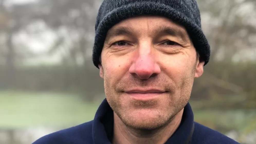
Roo Campbell, from NatureScot, said burrows are very difficult to detect
The beaver population in Scotland has doubled in three years to about 1,000, mainly concentrated around the River Tay catchment.
Legislation was introduced in 2019 to make beavers a protected species, which made it illegal to disturb or kill the animals.
But burrows which pose a danger can be destroyed if a licence can be obtained from NatureScot.
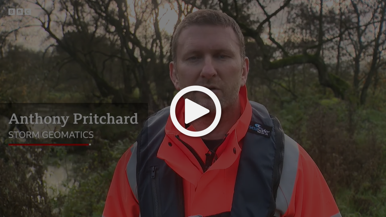
Anthony Pritchard, from Storm Geomatics, which is carrying out the survey work, said the technology was normally used to assess flood risks.
He said: “By having a better understanding of how many burrows there are, where they’re located, do they lie dormant, how many does a beaver family make? -all this sort of information is unknown at the moment so we can create a better understanding.
Photo Credits: BBC, NatureScot, Norbit