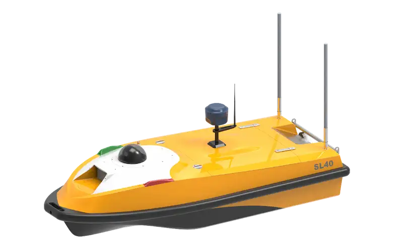
Compact USV for Inland Waterway Hydrographic and Bathymetric survey.
Flagship USV for Shallow-Water Surveys
SL40 is OceanAlpha’s flagship inland grade USV, purpose-built for shallow-water hydrographic surveys, bathymetric survey, and flow rate assessments. Refined through years of real-world use and continuous upgrades, it delivers unmatched stability and reliability—making it the safest, most proven choice for your inland water missions.
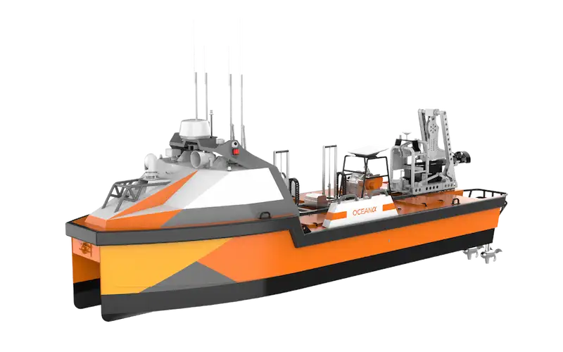
Rugged Architecture for Field Operations
The SL40 is a thoughtfully designed compact USV built for real-world use. Every component, from the hull to the propulsion system, was engineered for durability and efficiency.
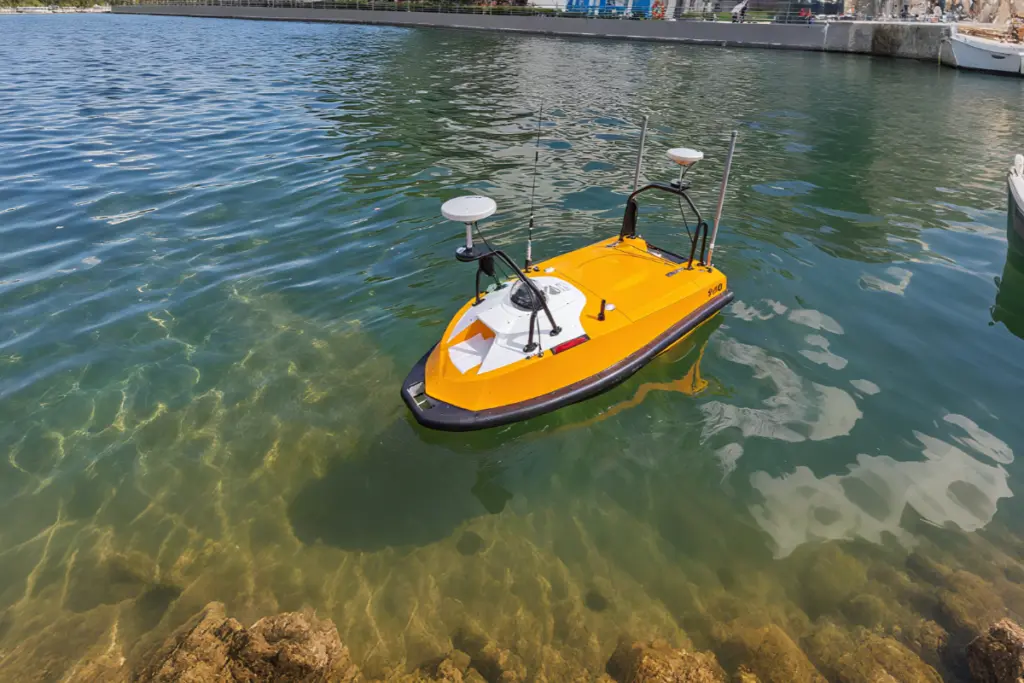
Shallow – Water Navigation
With only 15cm draught, SL40 can navigate and operate effectively in narrow inland waterways, shallow rivers, and coastal areas where conventional vessels cannot access.
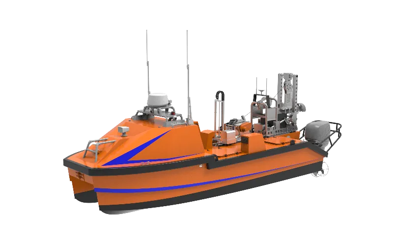
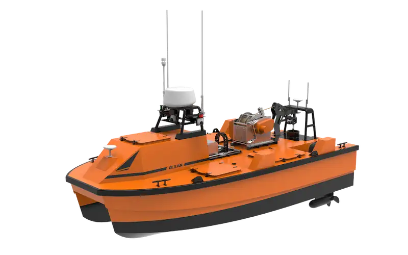
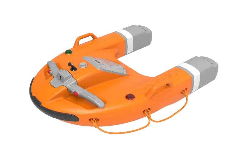
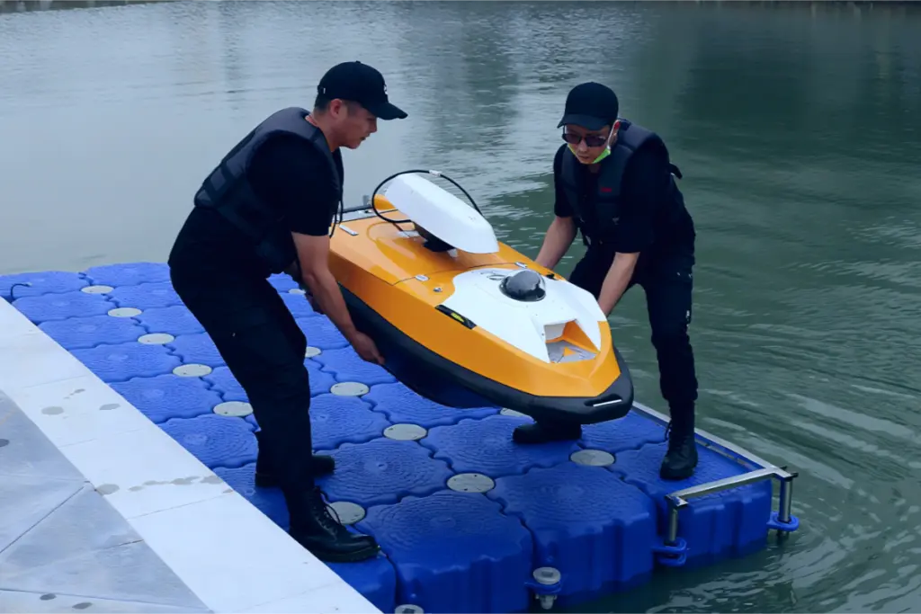
Compact Portability
The SL40 features a compact, carbon-fiber hull—about the size of a large suitcase (1.65m × 0.55m × 0.38m) and weighing as much as two travel backpacks (42kg with dual batteries).
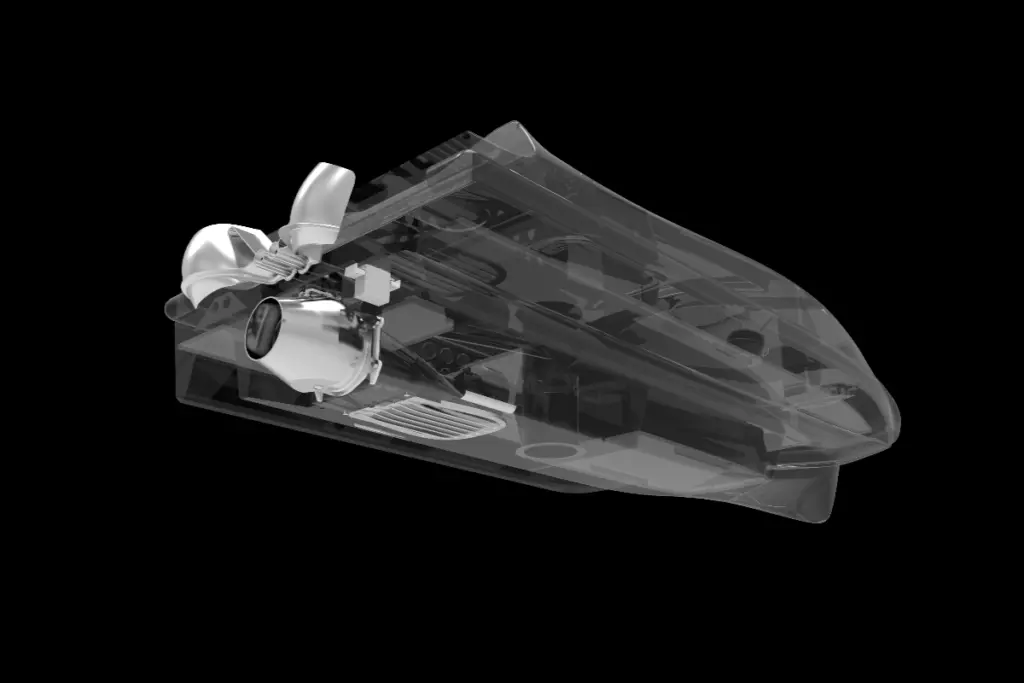
Tangle Free Propulsion
Powered by a debris-resistant waterjet thruster, SL40 reaches 10 knots while avoiding tangles in weeds and floating obstacles—ideal for messy shallow waters.
Enduring Operation and Quick Swap
With 8-hour endurance @ 3 knots and field-swappable batteries, SL40 powers full-day surveys without downtime.
Dual Control Options
The SL40 USV offers two control options, being operable via remote control for precise human intervention and equipped with an autopilot system for autonomous navigation and task execution.
Radio Remote control with handheld terminal, communication range up to 1km.
Autopilot under autonomous navigation, communication range up to 2km.
Wet Payload Flexibility
SL40 provides flexible deployment of wetend payloads through two moon pool options—either a compact 210mm × 210mm square pool or an extended 210mm × 275mm rectangular pool—enabling seamless integration of surveying instruments including:
Teledyne ODOM E20 SBES
R2 Sonic 2020 MBES, Kongsberg M3 MBES
Valeport SVS
YSI EXO2s
Solution
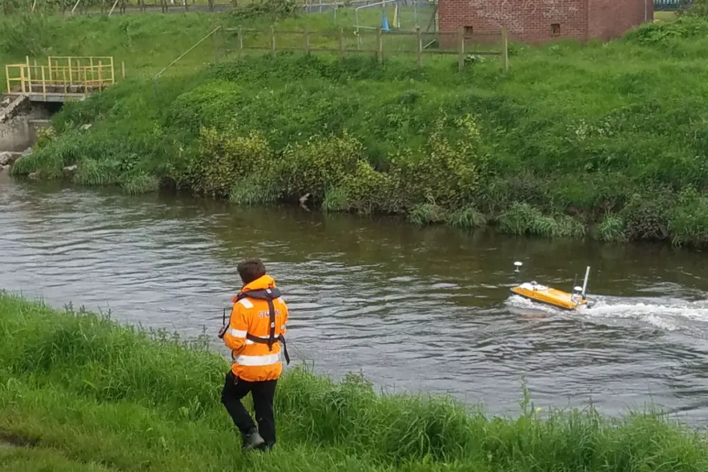
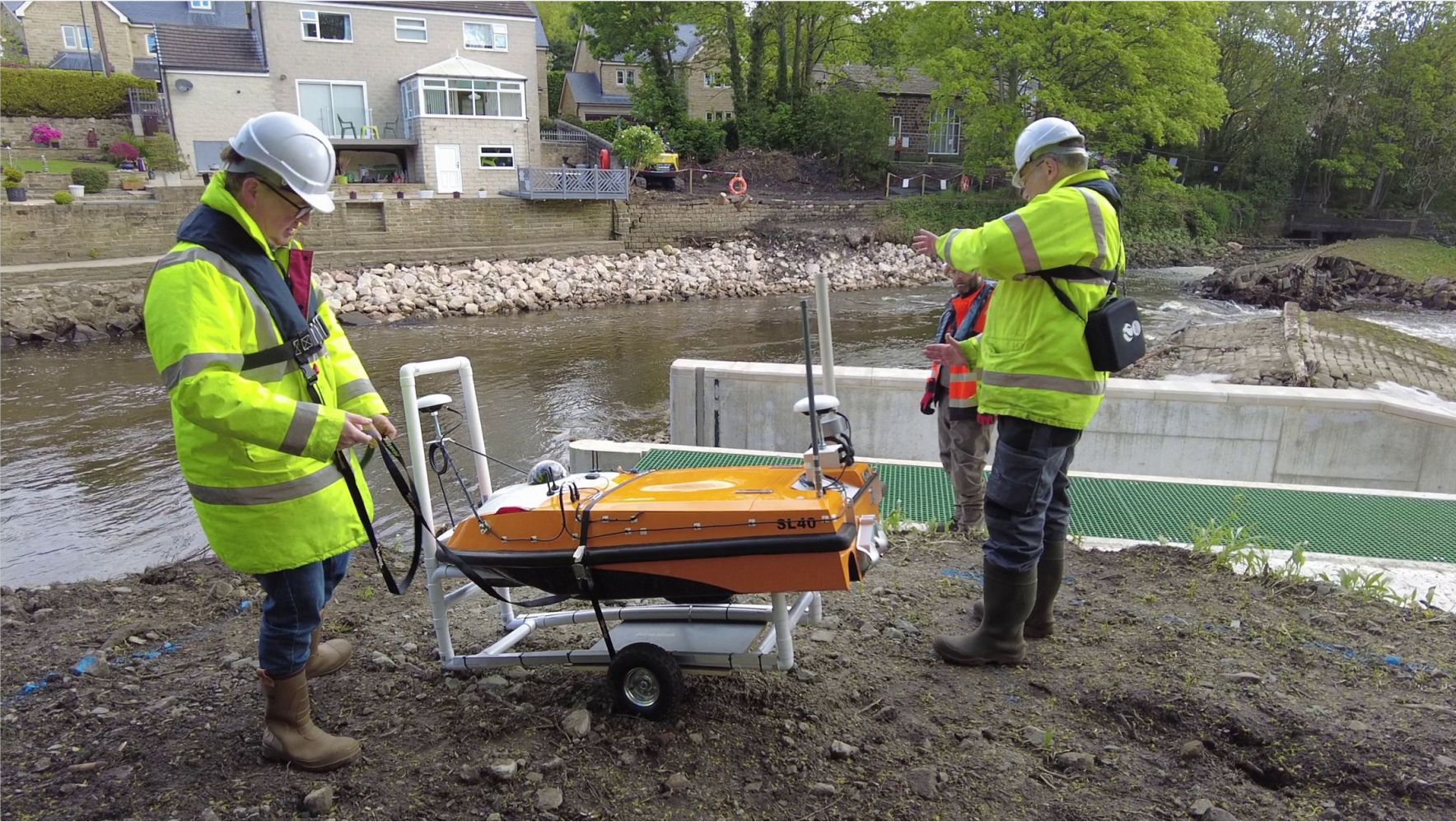
Inland Water Survey
Compact USV solution specifically for riverine/canal challenges—redefines reliability in inland waterway survey.
The field test demonstrated the SL40 USV’s exceptional stability as a multi-sensor platform, delivering clear underwater maps and accurate 3D above.water imagery in a single deployment.
Hamburg Port Authority chose OceanAlpha SL40 USV as the autonomous platform. Kongsberg provided the platform with sonar equipment and integrated mission equipment.