| Date | April 2019 |
| Location |
200 meters off a triangle island in Zhuhai, China |
| Equipment |
M80 multi-function USV Reson T20P multibeam echo sounder POS MV Wavemaster inertial navigation system HY1200 sound velocity profiler |
About the survey area
The coastline of this triangle Island is about 4.9km long, with a projected area of 0.87 ㎡ and a natural surface area of 0.96㎡.
The island is 1.6 km long and 1 km wide, and the narrowest part is about 200m wide. Water depth around the survey area is 7 m on average. There are dry reefs and clear reefs on the south coast.
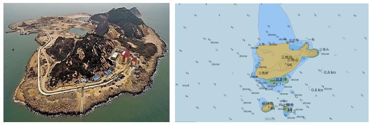
Pic The Triangle Island and surrounding sea map
OceanAlpha was entrusted by the National Oceanic Administration to survey the topography and bathymetry along the coastal line of the island by using unmanned boat and multibeam echo sounder. The multibeam survey area covered the water area 200 meter off the coastal line except for any extreme shallow area less than 2 meters deep which is too shallow to apply the MBES.
Process
The whole process included navigating to the survey area, confining the survey area, setting up survey lines, autonomous surveying, recording data and returning.
With a maximum speed of 12 kn, it took the M80 USV 2 hours to arrive at the triangle island. After arrival, the M80 USV started to collect profile sound velocity data with an HY1200 SVP, then it’s driven remotely to find out the 2-meter water depth contour line around the island. Meanwhile, surveyor used the USV Navigation Tracking Function of the base station software to confine the survey area.
Basing on the actual water depth, MBES swath wide (4 times of the water depth) and the full coverage standard which requires 10% of scanning overlap, surveyor set up a group of parallel survey lines and checking lines. Receiving the mission command, the M80 USV began to navigate according to the planned survey line and collected and recorded bathymetry data. A PDS and XTF file were also generated and saved for post-process.
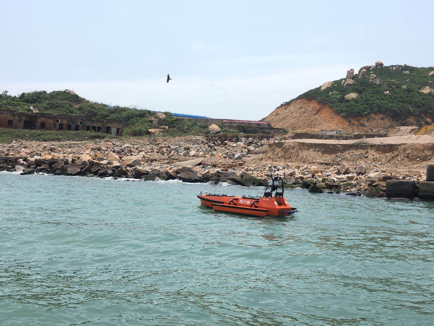
Pic M80 Surveying around the Triangle island
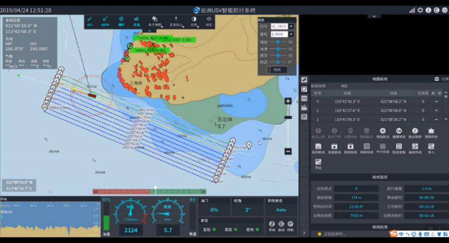
Pic Base station software monitoring the survey in real time
Result
It took the team 2 hours to survey the water depth and topography of the western sea area of the island. While 1 hour was spent on confining the 2m contour line, another hour was for autonomous surveying. 10 parallel survey lines of 500-meter-long each were set, making up an effective survey range of 5 km.
It took the team 5 hours to survey the water depth and topography of the northern sea area of the island. While 1.5 hour was spent on confining the 2m contour line, another 3.5 hour was for autonomous surveying. 10 parallel survey lines of 300-meter- long and 3 checking lines of 400-meter-long were set, making up an effective survey range of 20 km.
On the east and south side of the triangle Island, there is a big variation about the water depth and the survey area was larger than the other two, which required larger amount and higher density of survey line setup. The total survey rage of this area is 41 km.
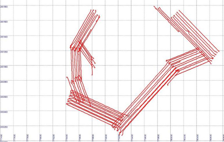
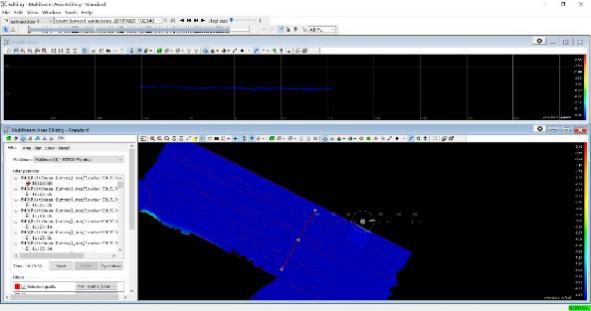
Pic Survey line record
The collected MBES data was processed by a PDS2000 Post Process software in a multibeam angle of 135°. The survey line sector shows that the beams are spliced seamlessly, the overall trending is complete, and the data is in high quality. One survey line was evaluated and the result shows it meets the IHO-44(IHO Special Order)Premium standard.
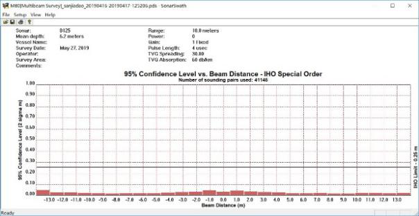
Pic MBES data sector splicing effect and IHO-44 Special Order evaluation
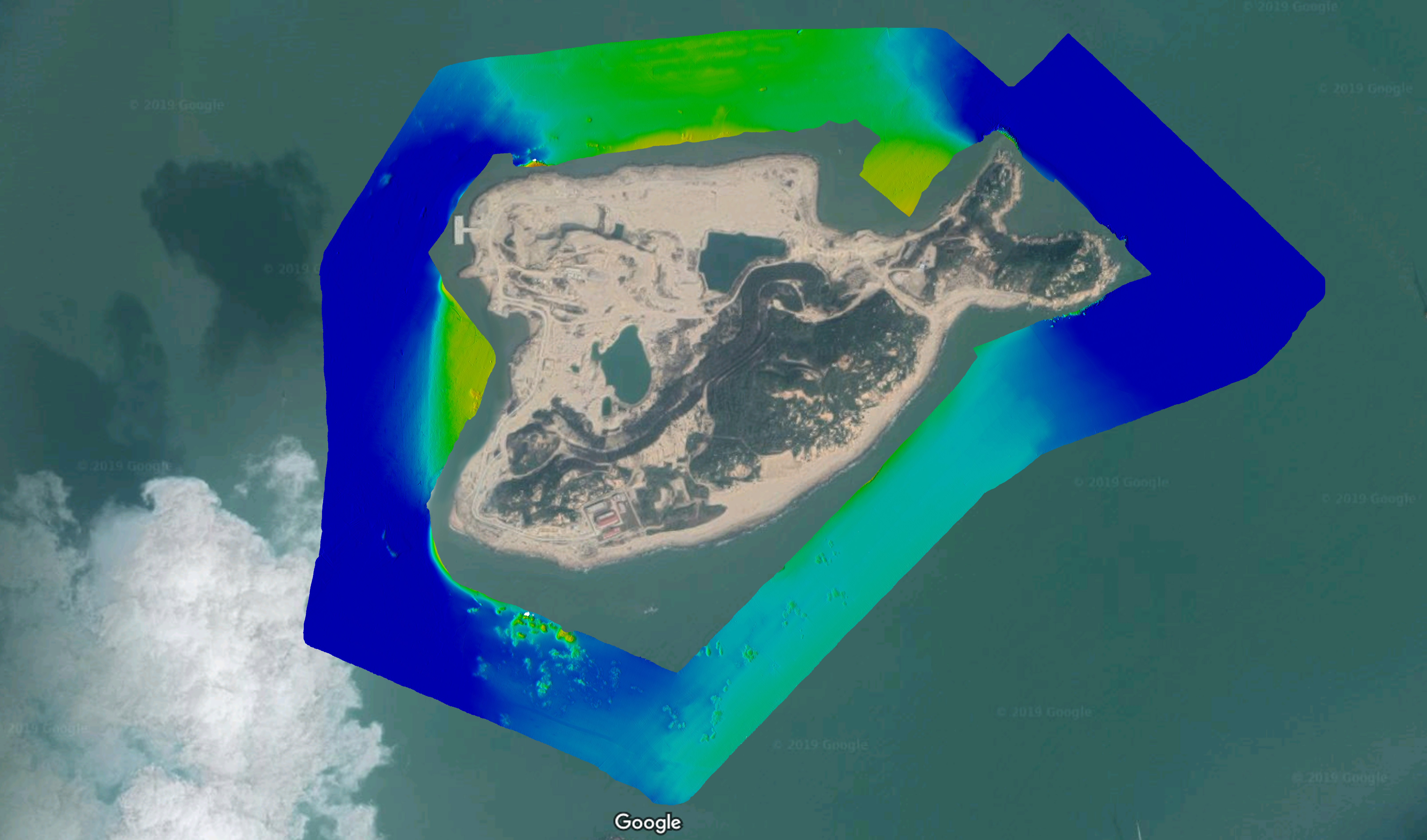
Pic Water depth rendering map of the triangle island
From the post-processed data map, it can be seen that water depth in water channels on the west and east side of the island are with a relatively deeper depth of 10 meters. Water depth in the north and south side are shallower and there are lots of dry reefs and submerged reefs in this area.
This project is a solid proof that USV is an efficient and developed platform for off-island bathymetric and topographic survey, and the data quality can reach IHO-44 Premiere Standard.
The USV can obtain bathymetric data from the extremely shallow area around island reefs, providing necessary data support for marine navigation and island development.
The working efficiency can be dramatically improved by using multiple USVs of different types to survey synchronously when the weather and underwater topography condition are too complex.