01 Background:
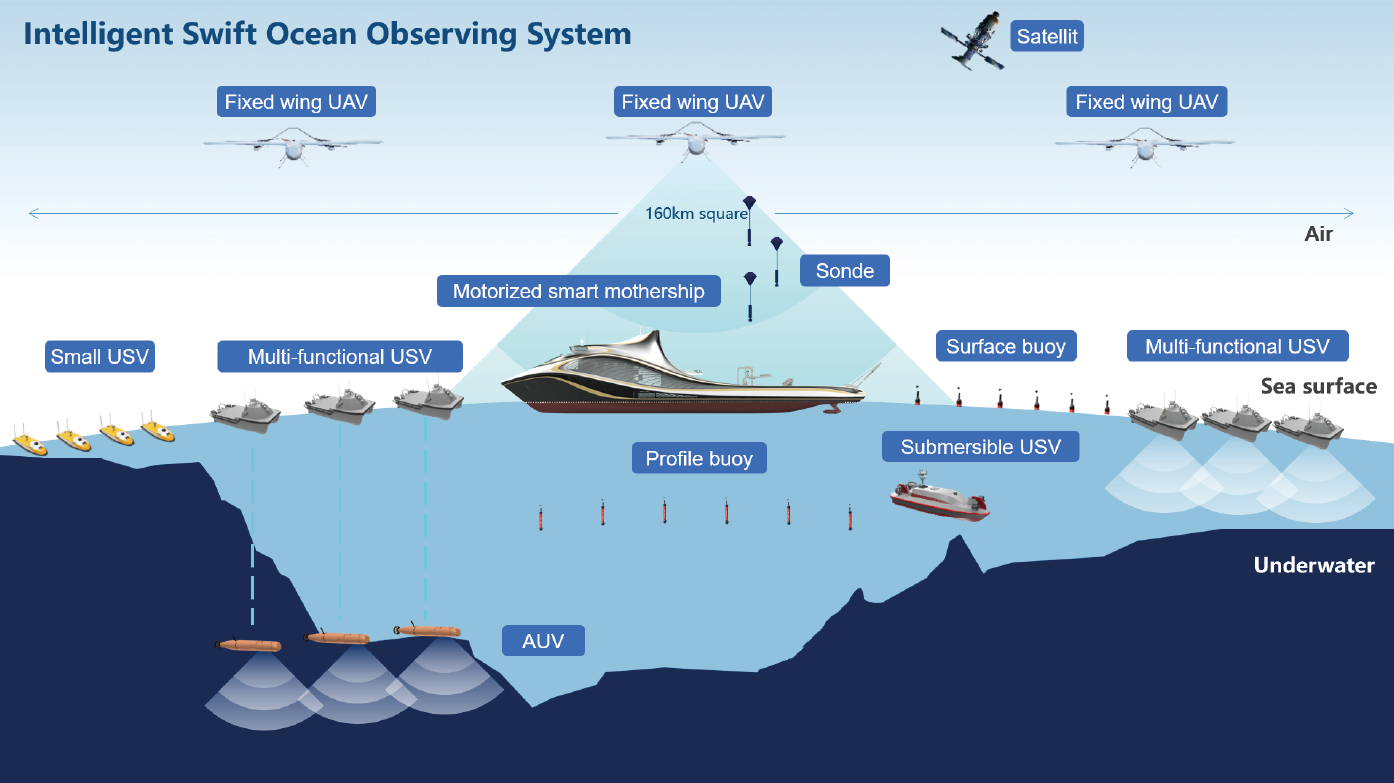
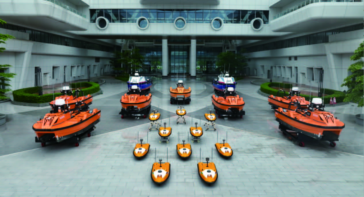
Based on the existing USV cluster control technology, it is proposed to use the smart mother ship as the carrier, and use various types of unmanned platforms in the air, sea, and submarine to form a cross-domain collaborative network to build a set of ” Intelligent Swift Ocean Observing System “(ISOOS). As a vehicle and control center for a variety of unmanned equipment, the smart mothership can carry a large number of unmanned boats, drones, autonomous underwater vehicles, and other equipment to quickly reach the target area according to mission requirements, it is able to deploy unmanned vehicles efficiently with the launch and recover system onboard.
02 Solution:
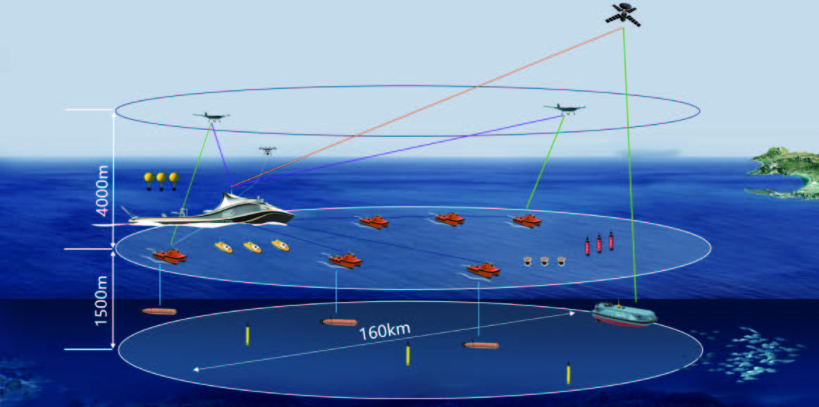
To build a cross-domain collaborative three-dimensional observation network from 4,000 meters in the air to 1,500meters underwater and cover 160 kilometers horizontally, providing a brand-new ocean observation way, so it has far-reaching scientific significance and broad application prospects.
(Solution 1 )
(Solution 2)
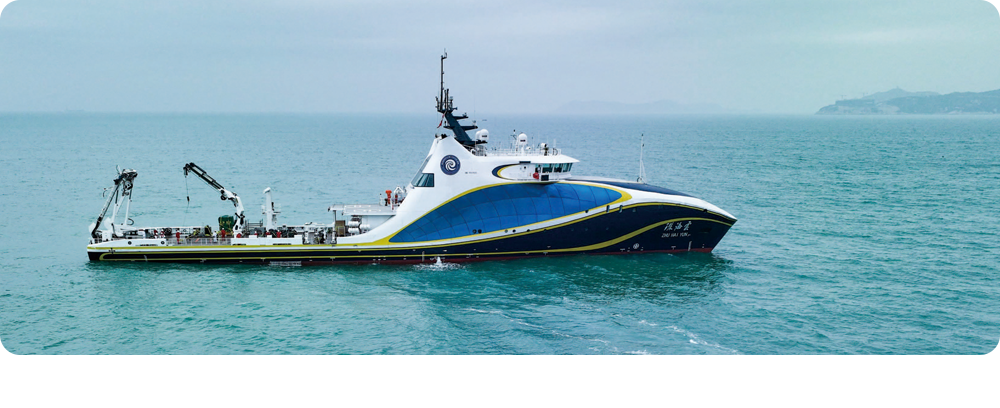
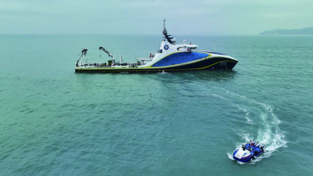
The “Zhuhai Yun” intelligent unmanned system mother ship with No, R1, M, and I intelligent symbols can carry large USV L25, medium USV M40P, small USV SE40, vertical take-off and landing drones, unmanned underwater vehicles, etc.
 |
 |
03 Capability:
3.1 Efficiency Improvement
Increase the efficiency of marine surveying and mapping by dozens to hundreds of times.
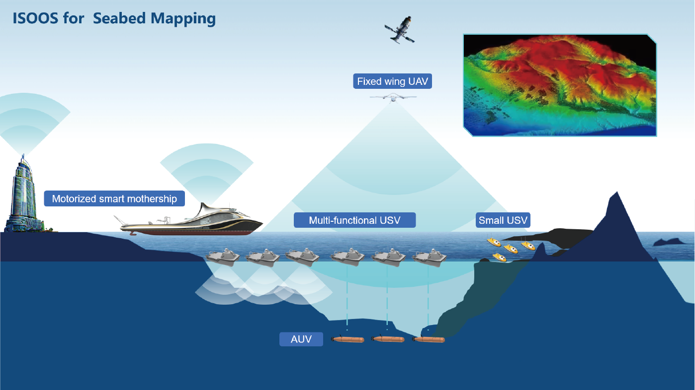
Schematic diagram of seabed surveying and mapping
Large USV on the water surface and autonomous underwater vehicles work together in deep water areas, Large USVs are used for multi-beam echo sounder surveys in shallow water areas, and small USVs are used for single-beam bathymetry survey in ultra-shallow areas. A variety of unmanned systems work together to improve the efficiency of marine surveying and mapping by dozens or even hundreds of times.
3.2 Efficiency improvement
Efficient survey in offshore oil and gas and offshore wind power pipeline, cable detection and engineering.
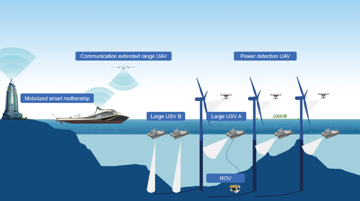
Schematic diagram of offshore wind farm operation and maintenance
Release a formation of at least 6 large USVs, 3 of which are equipped with multi-beam and side-scan sonar, and 3 are equipped with sub-bottom profilers to detect the buried/suspended situation of cables, and the synchronous operation of multiple boats improves the performance of large-scale offshore wind farms survey and maintenance efficiency.
3.3 Complete the mission impossible
Enhance scientific research and complete the observation of special physical ocean phenomena.
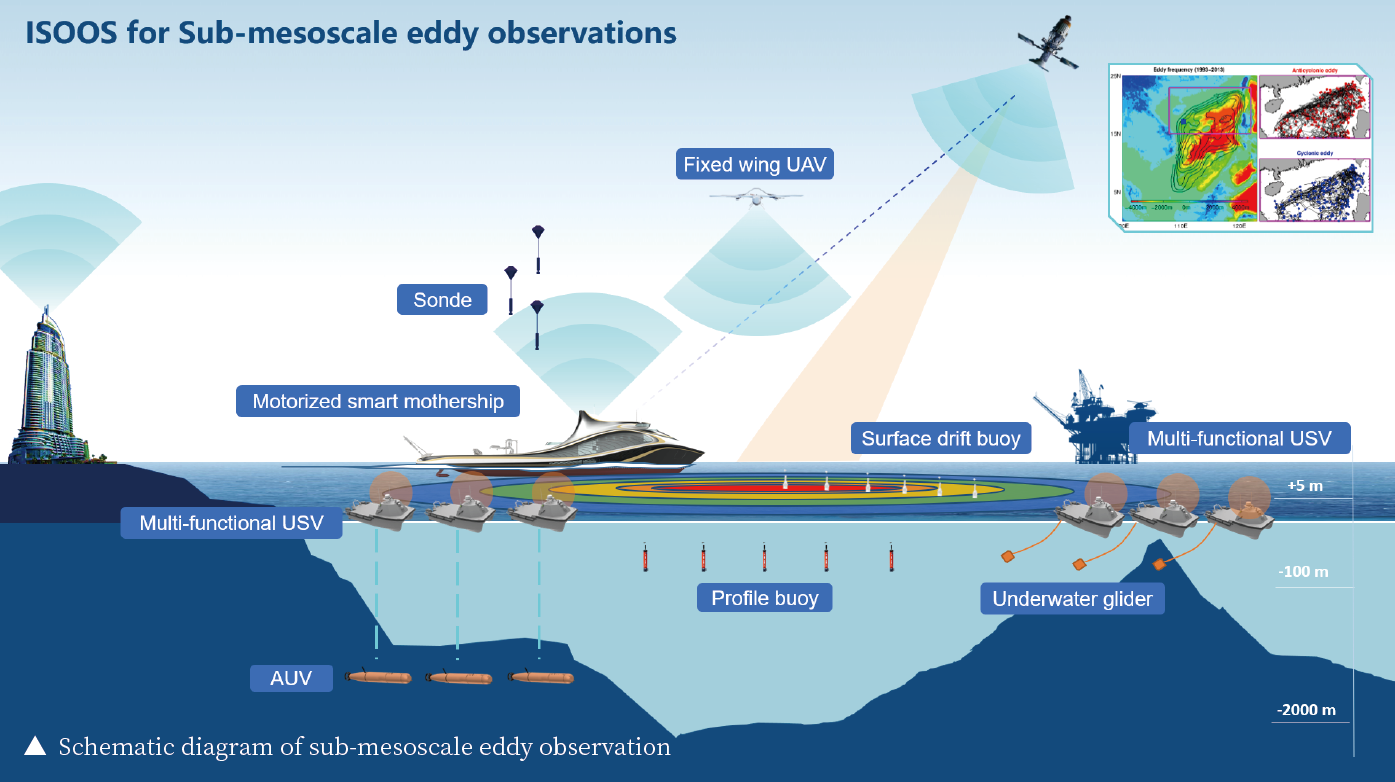
Using the network of large USV equipped with automatic towing winches, synchronously acquire high temporal-spatial resolution three-dimensional data of the upper ocean and the sea-air interface. Supplementary observations provided by autonomous underwater vehicles, profile buoys, surface drifting buoys, and drifting small floats.
3.4 Complete the mission impossible
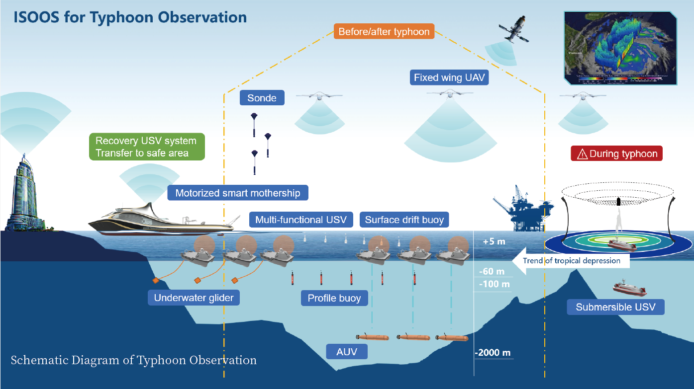
Serving disaster reduction and carrying out observations of severe weather such as typhoons.
3.5 Abundant application possibilities
Instead of the existing seismic survey method to carry out mineral resource survey, the scope of the seismic survey can be expanded, and the time efficiency of oil and gas exploration can be increased several times. A wide range of underwater object detection can be carried out in defense applications.
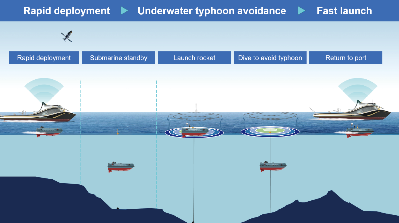
Implement multi-node cross-domain network stereoscopic observation before and after the typhoon, and deploy and recover the submersible unmanned vehicle. During the typhoon, the submersible unmanned vehicle mainly tracks and observes the typhoon and launches sounding rockets in the center of the typhoon. Disposable profiling buoys, surface drifting buoys, and small drifting buoys can collect data before, during, and after a typhoon. The operation mode of the submersible unmanned boat is shown in the figure below.
04 Features:
4.1 Agility
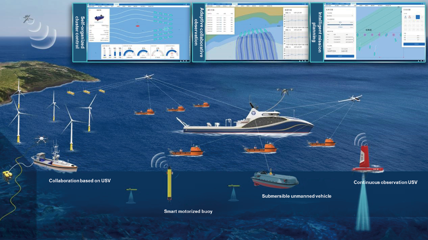
Based on the intelligent mother ship, achieve the rapid long-distance transition, deploy the recovery system in batches, ensure the rapid launch of the unmanned system. Use the air-sea submersible unmanned system equipment to carry out large-scale simultaneous observation.
4.2 Intelligence
Based on the task-oriented adaptive networking scheduling strategy, optimize the platform and system level, improve the collaborative control capabilities of wide-area, multi-node, air-sea, and submarine cross-media networking, and ensure the intelligence level of task scheduling. Improve the effectiveness of wide-area and cross-media networking communication systems in complex marine environments, and ensure the level of intelligence in network link optimization and resource allocation.
4.3 Adaptability
Guarantee the survival and operational capabilities of the system under extreme ocean conditions, and can cope with difficult tasks such as typhoon observation. Taking into account meteorological, power, biochemical, terrain, and other elements, large USVs with observation modes such as navigation, fixed-point, and towing can adapt to tasks in complex ocean environments, and cooperative networking to make up for the shortcomings of unmanned vehicle in high altitudes and deep seas.
05 Conclusion:
The ISOOS system is an advanced new technology system for marine surveys. It uses a smart mothership as a carrier and control center for various unmanned equipment and can carry a large number of unmanned boats, drones, and autonomous underwater vehicles according to mission requirements. Approach the target area quickly and release unmanned equipment in batches.
Efficiently complete oil and gas resource exploration, marine surveying and mapping, marine engineering survey, physical ocean observation, severe weather investigation, etc. It can improve the efficiency of marine survey work such as oil and gas resource exploration by several times or even dozens of times, and can also provide colleges and universities with tools for large-scale underwater object detection for defense security, and provide revolutionary support to national marine science, marine engineering, and maritime defense.
— END —