
Unmanned Boat Assist To Mitigate Internal Erosion Risks on A Embankment
Background
The water level of Xinjiang River, the second largest river in Jiangxi Province, China, rose rapidly due to continuous heavy rains. Over-long immersion at high water level will increase the risk of internal erosion on the embankment and eventually lead to breaching. Due to the surging rainfall, many embankments need to be checked immediately, and it is difficult for traditional manual inspections to complete the tasks within a safe deadline.
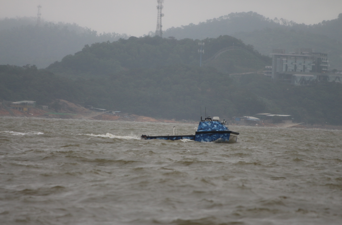
On July 21, at the invitation of the Jiangxi Flood Fighting Force, a technical team from OceanAlpha, a leading unmanned surface vessel(USV) solution provider, went to Xinjiang River to assist in the detection of potential internal erosion risks on embankments. After reaching the target area, the technical team scanned the embankment by using a 7-meter-long USV which was equipped with a multi-beam echo sounder system.
![]()
![]()
![]()
![]()
OceanAlpha’s USV working on a turbulent river
The technicians planed the survey route on the satellite map from the shore, and the USV automatically carried out the scanning mission according to the set trajectory.
In 2 hours, the unmanned boat completed the scan of 14km of the embankment and transmitted the data back in real-time. The technical team then produced a 3D underwater topography image on the spot.

Satellite map of the target river section Result of multibeam mapping
From the 3D image, it can be seen that the embankment is generally intact, but there are five locations with suspicious risks, three of which are suspected to be scouring trenches, and two are suspected to be landslides. The technicians analyzed the suspected locations overnight and provided officials with latitude and longitude coordinates, structural dimensions, and enlarged high-definition images. With these data, the Flood Fighting Force can conduct more targeted investigations and control the risk of embankment breach in higher efficiency.
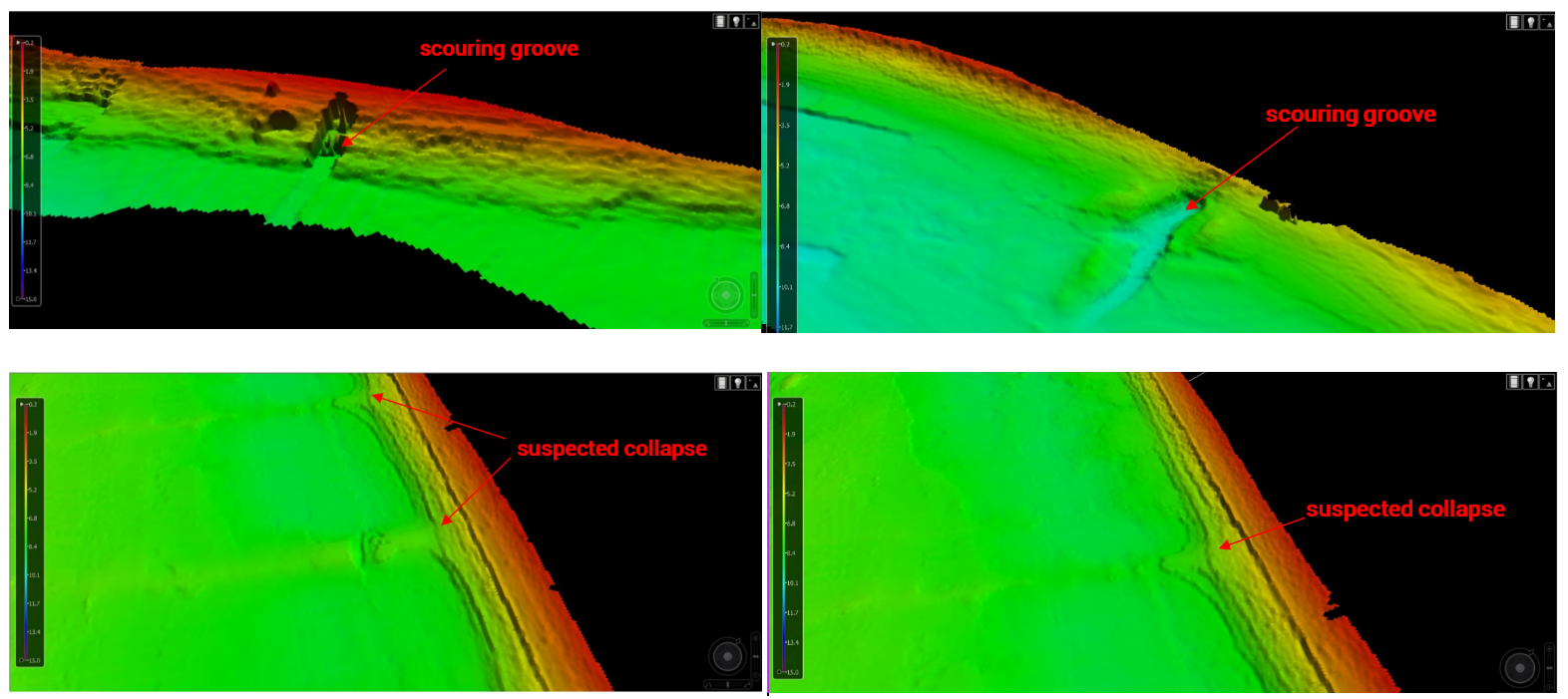
Part of the analysis result