Date: 18 December 2019
Location: A river in Loire-Atlantique, France
Equipment: SL40 USV, multi-beam sonar, 3D Lidar, INS and SVS
In response to the need for miniaturization and intelligent surveying and mapping of rivers, lakes, reservoirs, and other watersheds, OceanAlpha provides a set of integrated above water and underwater surveying solutions based on small USV platforms. The solution consists of a USV platform, a multibeam echo sounder, an inertial navigation system, a sound velocity sensor, and a 3D lidar.
Deploying multiple equipments to carry out different missions simultaneously is a huge challenge for small-sized USV platforms. Basing the payload and hull design of SL40 USV, OceanAlpha developed a highly compatible and effective package for multitasking which consists of an R2Sonic LLC 2020 multibeam echosounder(MBES), a Valeport MiniSVS sound velocity sensor(SVS), a Velodyne VLP-16 3D LiDAR and an SBG Systems Ekinox D inertial navigation system(INS). The installation is as below:

The INS, MBES and SVS are mounted integrately in the moonpool. Two navigation antennas are mounted separately on the bow and stern. The LiDAR is mounted 15cm behind the camera with a 3D printed stand.
After setting the route through the ground base station, the SL40 USV carrying the above equipment to conduct underwater and above water scanning and imaging synchronously at a precise point of a river in Loire-Atlantique. TSL40 obtained high-quality 3D data of a bridge, the banks and underwater terrain efficiently.
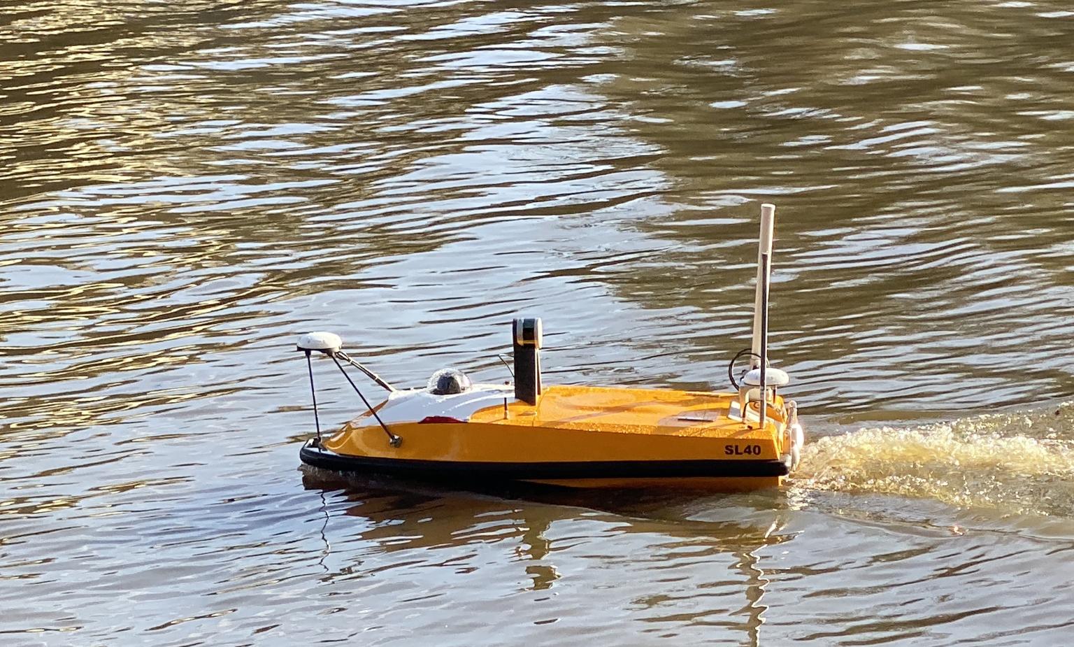
SL40 sailing on river
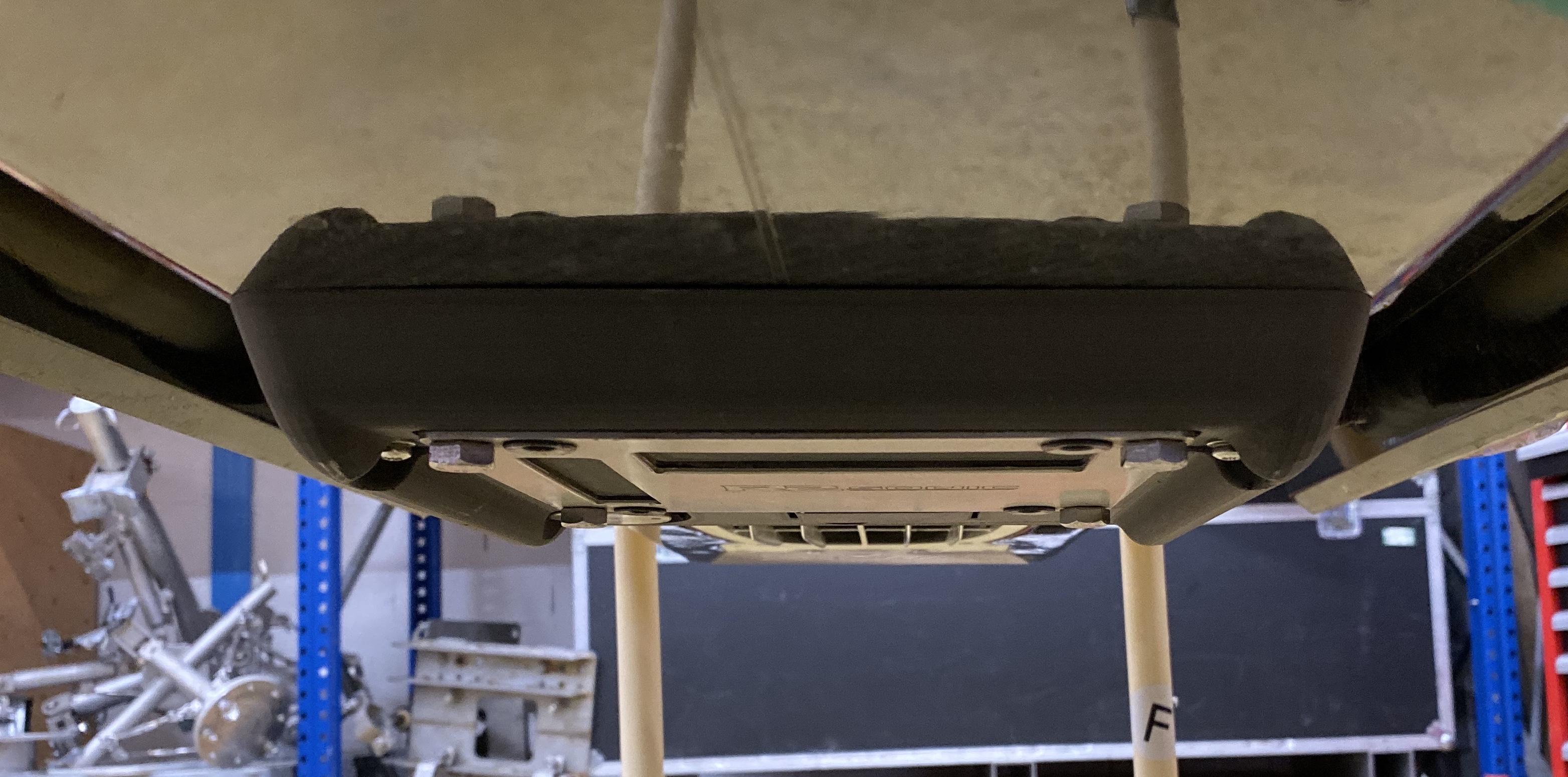
MBES mounting
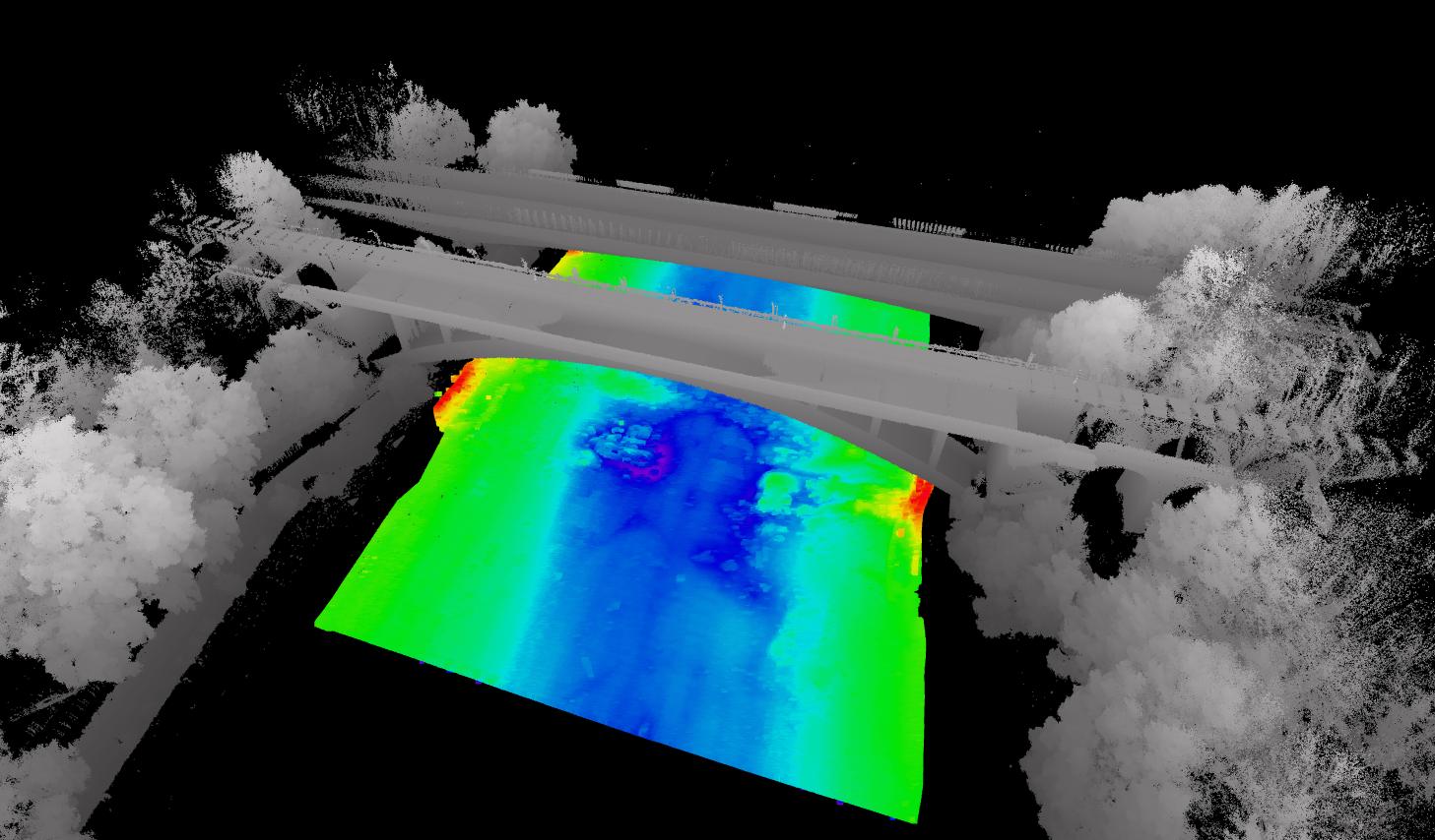
MBES and lidar result
At the field test, a clear underwater map and a 3D image above water were generated, proving the excellent stability of SL40 as an equipment platform.
Related Applications
We’d love to hear from you
Whether you have a question about features, trials, pricing, need a demo, or anything else, our team is ready to answer all your questions.